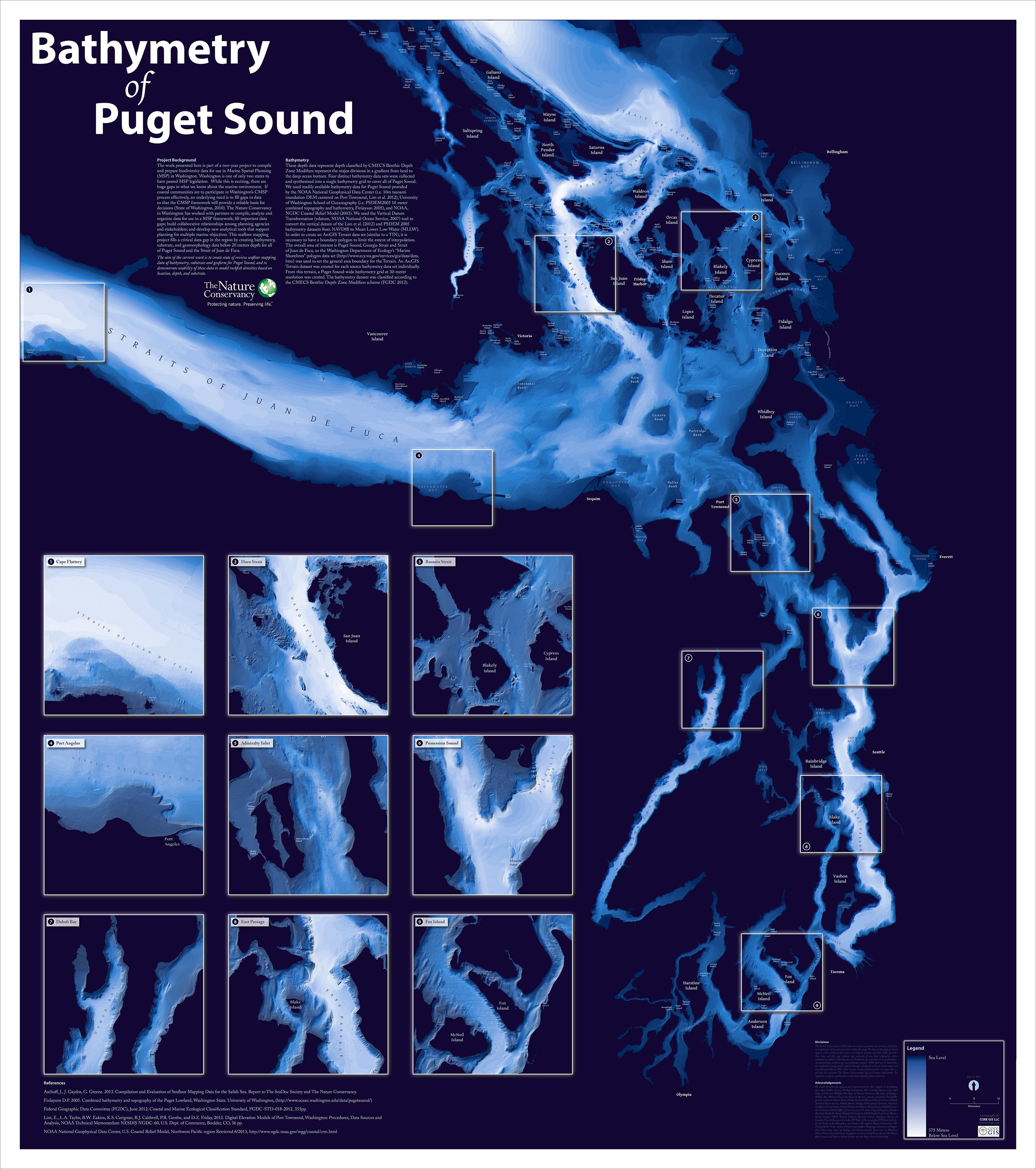
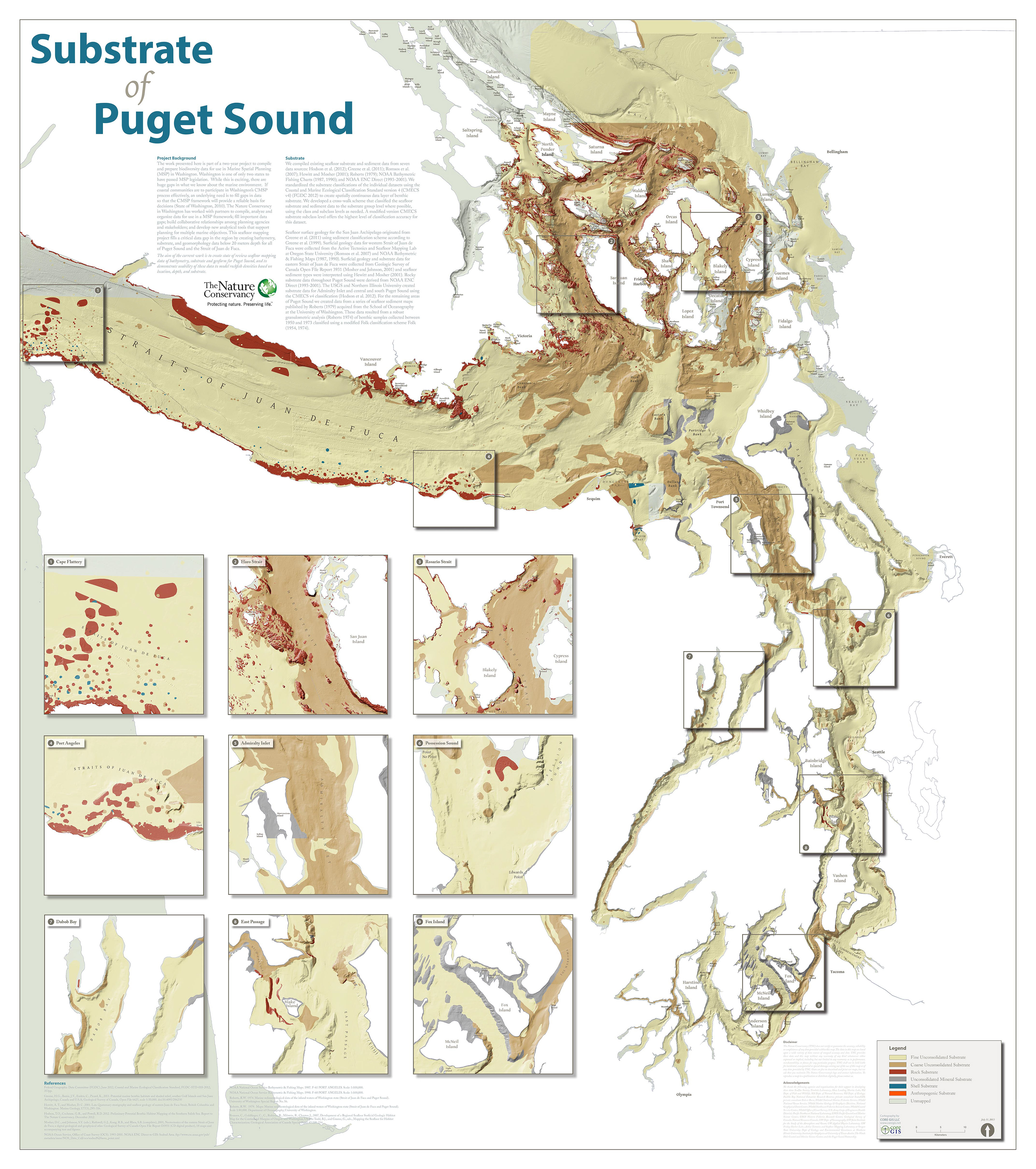
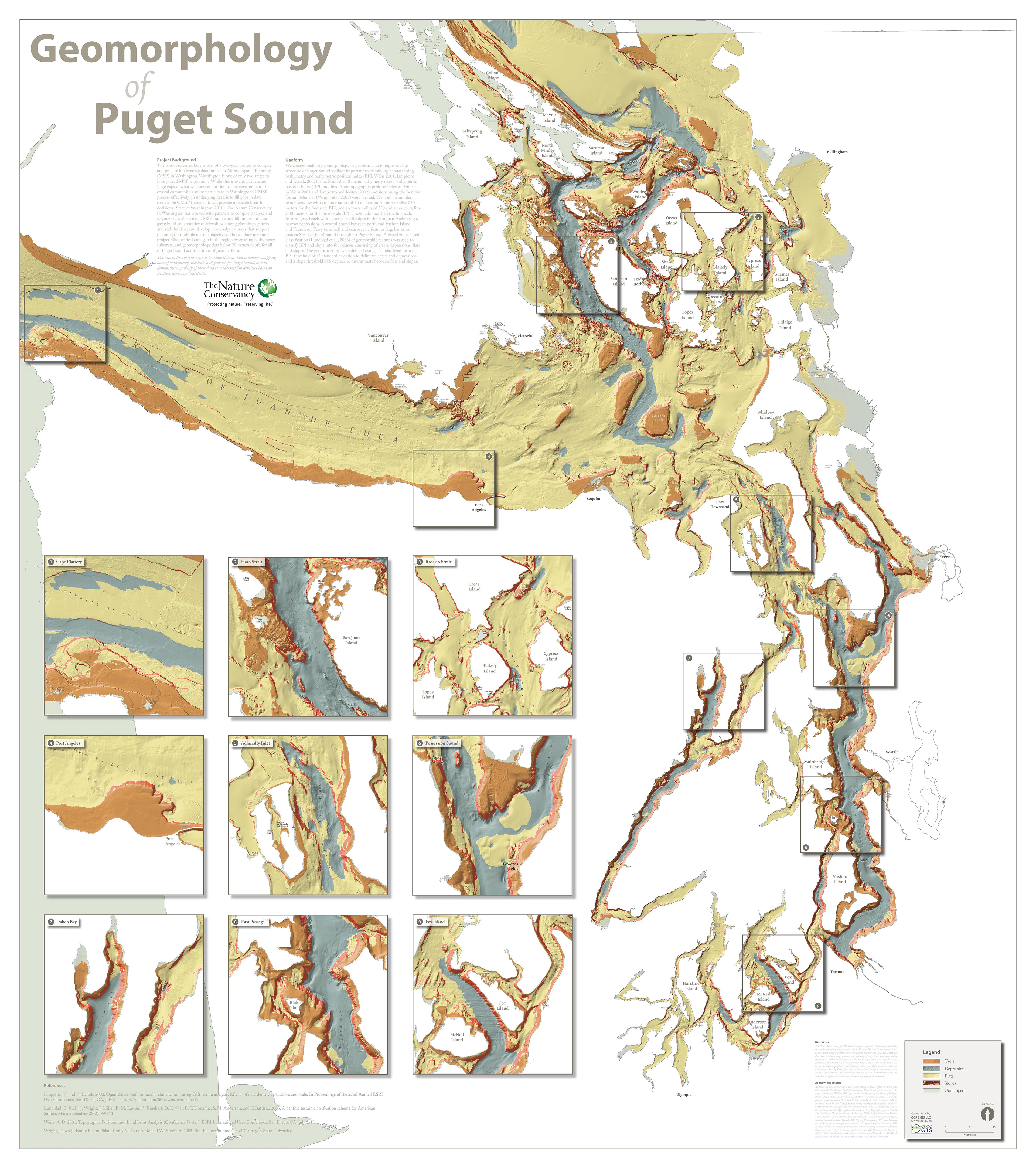
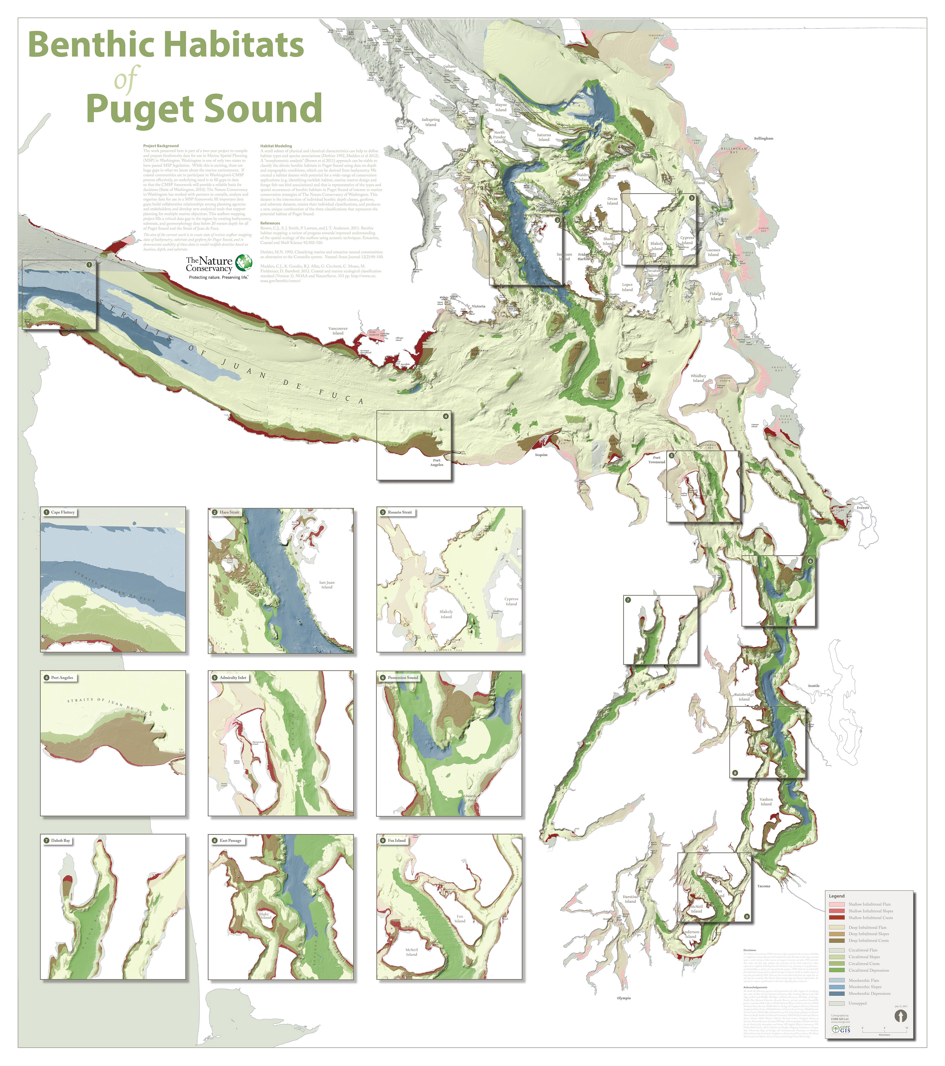
The Nature Conservancy recently completed a two-year project to produce biodiversity data in support of marine spatial planning in Washington. This seafloor mapping project fills a critical data gap in the region by creating bathymetry, substrate, and geomorphology data below 20 meters depth for all of Puget Sound and the Strait of Juan de Fuca. CORE GIS worked with TNC to produce four large-format maps to showcase the data and promote it throughout the marine research and conservation communities.